3rd Feb, 2021 10:00
Antiques, Interiors & Books including the Contents of Castell Gyrn

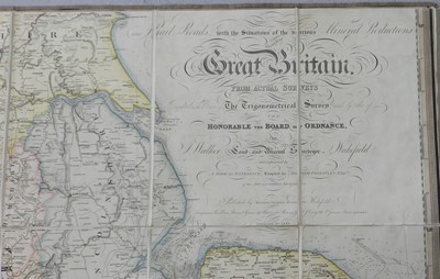
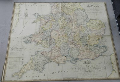
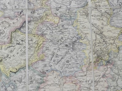
LARGE CANAL, RAILROAD and MINERAL MAP. Map of the Inland Navigation, Canals & Rail Roads with the situation of the various mineral productions throughout Great Britain. By J Walker, Land and Mineral Surveyor, Wakefield. Richard Nichols, Wakefield, January 1st 1830. 1880mm x 1590mm, disected in 48 sections on linen. Hand coloured. In the original leather slipcase, scuffed at extremities.
Sold for £800

