10th Nov, 2022 10:00
Books, Manuscripts & Maps Auction

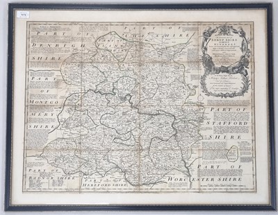


BOWEN, Emanuel, An Accurate Map of Shropshire
BOWEN, Emanuel, An Accurate Map of Shropshire, c 1765, 530mm x 677mm. Dissected on linen. Hand coloured. With Cary's map of Shropshire, 1805, 497 mm x 423mm. With Henry Teesdale's Map of Shropshire, c 1830, 420mm x 340mm. All framed and glazed. (3)
Sold for £65

