10th Nov, 2022 10:00
Books, Manuscripts & Maps Auction


Maps of Africa, Dorset, England and Wales
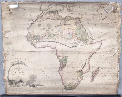
MAP OF AFRICA. Purdy, John, The Continent and Islands of Africa with all the recent explorations. Robert Laurie and James Whittle 1809. 1170mm x 1450mm. Hand coloured, in poor condition with loss at edges. Rolled. With map of Dorset, 1886, 1200mm x 1540mm. On a scale of one inch to a mile. On rollers. With a large W & A.K Johnson Railway Map of England and Wales, circa 1900. Rolled, in poor condition. With a large Bartholomew's Map of S. Wales and SW England, circa 1905, rolled, (4)
Sold for £550

