12th Jan, 2022 10:00
Antiques, Interiors & Books Auction


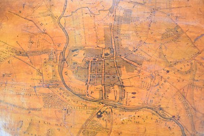
MAP OF LUDLOW by C Evans, 1832
MAP OF LUDLOW by C Evans, 1832. A Map of the Borough of Ludlow showing the limits as respects the election of members to serve Parliament as settled by an act passed in the third year of the reign of His Majesty King William the Fourth. By C Evans, land surveyor, November 1832. 555mm x 500mm. On a scale of about 9 chains to an inch. Wooden supports top and bottom. Varnish has browned, tears and wear
Sold for £280

