15th Nov, 2023 10:00
Books, Coins and Stamps Auction
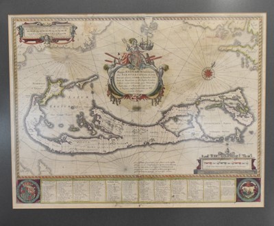
MAP OF BERMUDA. Mappa Aestivarum Insularum, alias Barmudas. Willem Blean, Amsterdam, circa 1660
MAP OF BERMUDA. Mappa Aestivarum Insularum, alias Barmudas. Willem Bleau, Amsterdam, circa 1660. 405mm by 535 mm. Outline hand colour. Lists of tribal names below map. Large central allegorical cartouche, French text to verso. Water staining to upper part of map. Framed and glazed.
Sold for £360


